Detail of a David Thompson map

Historical Maps

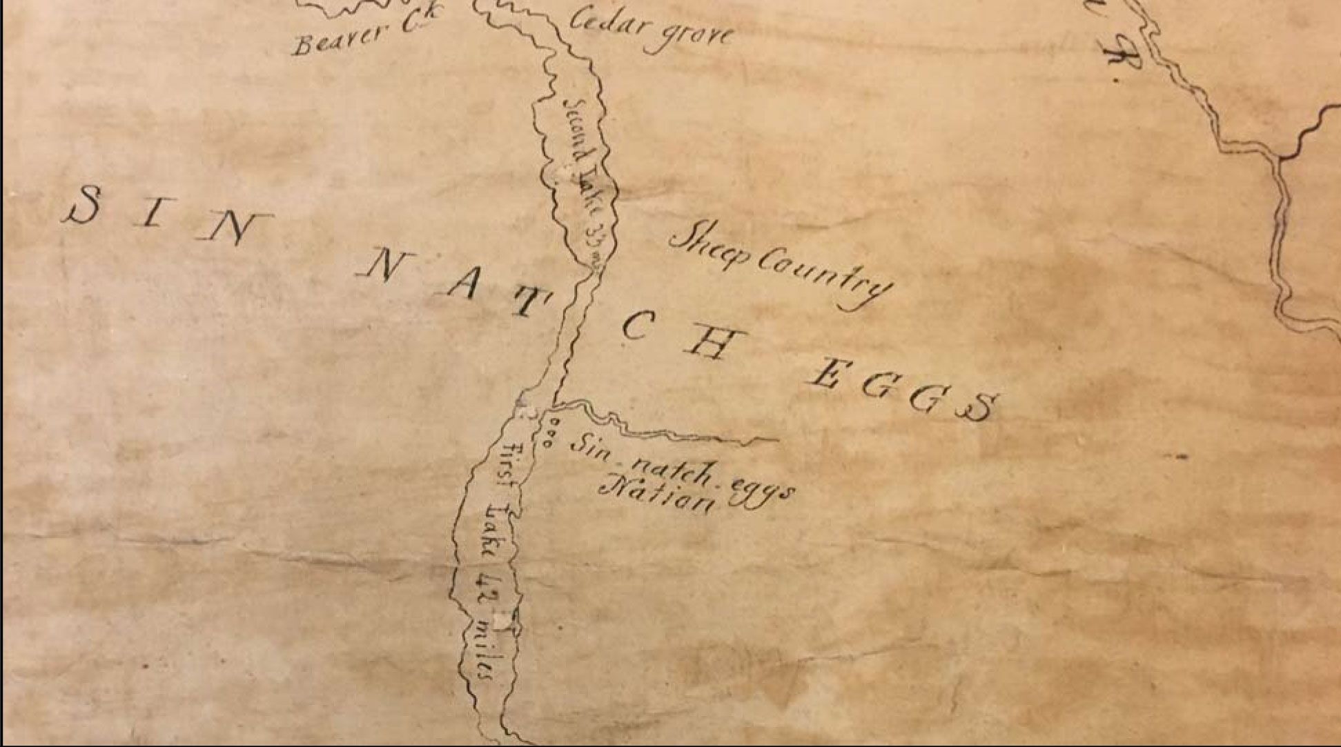
Tribal historian Richard Hart researched and presented historical maps in court as a record of our long inhabitation, in our Canadian homeland. Created prior to GPS or sophisticated survey tools, the maps express how challenging it was for explorers to navigate and map our mountain territory.
Figure 9 Ross, 1821, Detail. British Library, Add. MS 31,358 B. Detail shows Sinixt [Sin Natch Eggs] territory and village (“Sin-natch-eggs Nation”), apparently the headquarters of the Tribe. Also indicated are mountain sheep in the Selkirk Mountains and both Arrow Lakes. This detail is taken from the actual, original Ross map in the British Library.

In 1956, the BC government convened a panel of experts to publish an atlas, British Columbia Resources. Made available to schools, businesses and the general public, it identifies “Lakes” territory with boundaries that match what our ancestors have taught us.

Map showing Sinixt (Lakes) territory.
Sinixt (Lakes) as show in Map 12 on pages 25-26, of the 1956 atlas created by the British Columbia Natural Resources Conference. The caption notes the territory of the Lakes (Sinixt) is mapped as it existed in 1850.
Close up of map showing Sinixt (Lakes) territory.

Read Hart’s full article published in Cartographica and see the entire selection of maps here.

Print Friendly, PDF & Email
#elementor-shape.fill { display: none !important; }